Habersham County, Georgia
....the path less traveled
October 2006
Report by Wayne and Patty Brantley
(waynebrantley@hotmail.com)
The Georgia General Assembly on Dec. 21, 1830 enacted legislation claiming all
the territory within the limits of Georgia, and now in the occupancy of the Cherokee tribe of
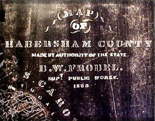 Indians; and all other unallocated lands within the limits of this State. The act also provided for surveying the Cherokee lands in Georgia; dividing them into sections, districts, and land lots; and authorizing a lottery to distribute the land.
In 1838 the United States began the removal of the Cherokee people to Oklahoma, as a result of the removal about 4000 Cherokee died along the way. The route they traversed and the journey itself became known as "The Trail of Tears". And so a country formed fifty years earlier on the premise "...that all men are created equal, and that they are endowed by their Creator with certain unalienable rights, among these the right to life, liberty and the pursuit of happiness.." brutally closed the curtain on a culture that had done no wrong. Sad piece of history, isn't it? Two years prior to the legislation that claimed the territory, the rumored gold for which De Soto
 had relentlessly searched, was discovered in the North Georgia mountains, could this be the real reason for claiming the Cherokee land?
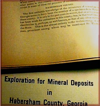
In the North Georgia mountains much of the gold and other minerals remain, and the land is still divided into sections, districts, and lots. This land system is used even today to give locations of mines and deposits, a good example would be at Mindat, if you go to the site and
look for corundum in Habersham County, Georgia you will find the following locations... "found on lots 125,126,127,131,132,133, and 134". Now you know exactly where to look... right!? Land lots have changed "some" over the last 175 years and the land lots that are listed on the Mindat site are grouped together at their location to form an area greater than 3,000 acres! Most of the sites listed are small prospect cuts less than 50 square feet in size, this wouldn't be that hard to find
 in a desert! I can tell you for a fact that the lots listed are in thick forest and are anything other than flat... right Pat!? LOL!
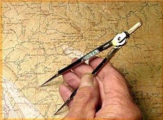
Many modern day maps and books can be wrong, most are reprints of the first originals and the information may have been changed, altered, or estimated. Many of the coordinates and formations given on modern maps can be off as much as 1/4 mile, I have found this to be true several times!
To get the most accurate information you must spend many hours researching the old with the new, only then can you get some idea for a starting place to begin your search for a location or deposit.
I hope this will give you some idea and in site as to the research and time it takes to locate deposits and prospects?
This has only been a very small piece of the puzzle to give an overall picture. If you are crazy enough to want to make your own path, before you can move forward, you must take a giant step backward!
What equipment you'll need to take with you on a prospecting trip can be as
 different as the area itself, but several things are basic to every trip.
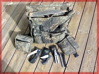
I have used several different type back packs and found that most just didn't fit my needs, so I designed one that was easy to use and still carry what was needed in the field. The pack is made from 1,000 denier cordura in Realtree Hardwood camo, the material is woven nylon and will out last cotton many times over.
The front part of the pack has four pockets that hold my Gerber saw, knife, multi-tool, mini-mag light, and B&L loupe. The main part holds my pick, shovel head, pry bar, and other stuff that will be needed. The two smaller hip bags hold GPS, compass, gun, maps, etc.
different as the area itself, but several things are basic to every trip.
I have used several different type back packs and found that most just didn't fit my needs, so I designed one that was easy to use and still carry what was needed in the field. The pack is made from 1,000 denier cordura in Realtree Hardwood camo, the material is woven nylon and will out last cotton many times over.
The front part of the pack has four pockets that hold my Gerber saw, knife, multi-tool, mini-mag light, and B&L loupe. The main part holds my pick, shovel head, pry bar, and other stuff that will be needed. The two smaller hip bags hold GPS, compass, gun, maps, etc.
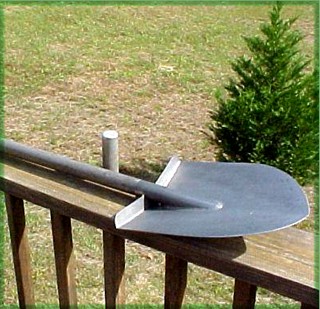
My walking stick, pick, shovel head, and pry bar, are custom made titanium for light weight and durability. It's easy to convert the walking stick to a full size shovel by removing the protective cap and screwing the head in place.
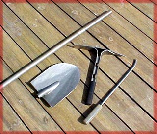
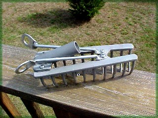
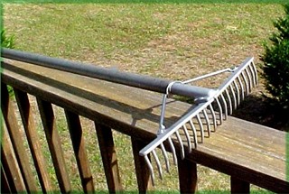
The walking stick can also be converted into a full size rake which makes it nice to roll out chunks of #9 in loose dirt or reclaim a dig site. The rake head is made from stainless steel and unfolds to be screwed onto the walking stick.
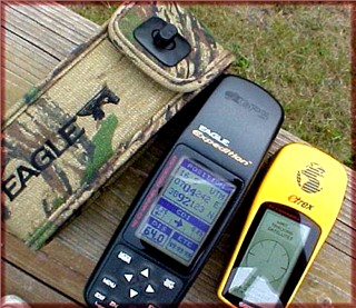
I carry two GPS, one is an old Eagle that I've had for many years, it can get a location fix even under heavy tree cover. The other is a small Garmin Etrex which is a back up and to make sure the Eagle isn't off or doesn't match the lay of the land. I carry it in my shirt pocket most of the time and leave it on, that way it tracks my route in case I need to retrace my steps to go around an obstacle. I only use the Eagle to locate my present location so I can plot my moves on the map. Both use the same batteries, give current time and even sun-up and sundown for my location. A GPS is only one tool I use for navigation, never use it as your only one!
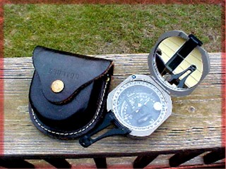
A compass is your main tool to navigate, get the best you can afford! My main compass is the Brunton Pocket Transit, it is a very high quality compass and is the standard with most geologist. My back up is an old Taylor that I've had for over 35 years but is rarely used. The Brunton can shoot lines less than one degree of arc and the mirror can be used as a signal, if the sun is up.
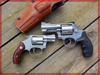
In this world you never know what you will run into, trouble may be at the next turn? For this reason we carry one and sometimes two pistols. This is a personal choice and everyone has different thoughts on the subject. If you decide to go armed you must know ALL safety requirements and their use! Both Pat and I are certified with the handgun, we both use revolvers because they are easy to load and shoot, some automatics will jam and are more complicated to use. We carry stainless Smith & Wessons in .38spl and .44spl.
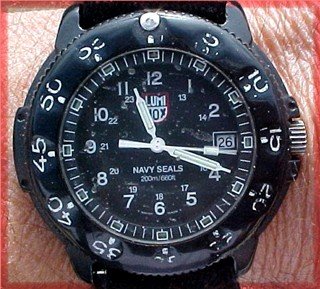
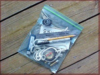
One "tool" that is often over looked is a watch and you need to have a good one. You only have so much daylight and you must know how long it will take you to return to your camp or truck. I have an old Lum Nox that's been through hell and half of Georgia, it's seen some rough times! I can read the time in any light without pushing a button and being analog I can use it as a compass if the sun is out! In the pack I also carry a zip-lock bag with steel rule, pencil and pen, extra bullets, batteries, compass, note pad, and other small items.
Maps!? This is where all your research is put into a "plan" and you will need
several different ones. I use Maptech to generate field maps
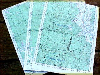 on standard paper in several different scales, this makes them easier to carry than larger or full size maps.
Each map I print is the same as a regular topo map which makes it easy to cross information to geology and forest service maps. Each map has the UTM coordinate grid on them making it easy to find your location using the GPS. I can also print dig sites or other info needed on them using the software.
One important note... regular topo maps and forest service maps are NOT the same! A forest service map is usually two color showing what land is National Forest land. Green on a regular topo is ground cover, trees, etc., not National Forest land.
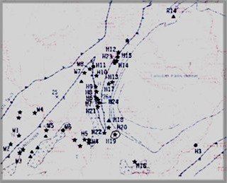
The first map I will show you is a regular topo map of one of the areas in our search. The second one is a forest service map showing what land is National Forest, they are the same except for showing NF owned land.
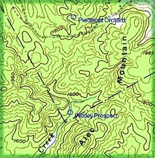
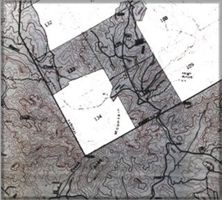
Notice on the bottom map (NF) that the lot number is shown on each section of forest service land. Both maps are Clarkesville NE, GA 7.5 minute series quadrangle maps. Part of the NF map will be printed smaller to be carried to the field to make sure we don't hear gun shots! You must know where property lines are!
Many times I will just mark geology formations on the maps I carry, this area has so many that a separate map was excluded.
This is only the basic things that was carried, other items such as cell phones, first aid, and other tools weren't talked about. One thing about cell phones, we checked to see if we had service before going into the forest and at different points along the way. We even called home at one point to make sure we could phone out from the forest and it worked... but Tinker didn't answer the phone!:D
We made a written list of the things we were going to take and each was crossed off as it was loaded, a list needs to be made several days before you leave to give you time to think of the different stuff you'll need to carry on your trip.
Report continued . . . . . . .
Click Here for Next Page