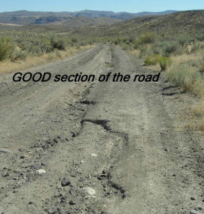
Hello Rockhounds! I wanted to document this interesting area although the number of Private Claims that have popped up are "alarming" (to us) and it's making it harder to figure out where to pick up rocks out there! It's also a 4WD and high-clearance-vehicle only road unless you don't mind banging the tail and scraping the bottom of your car a few times. Our trailer hitch got banged real hard one year. There were not less than 12 areas where water had carved ACROSS the road This year, a foot or more deep, wide OR narrow and steep trenches, and a vehicle MUST crawl and lurch from side to side very cautiously (other years the across-ruts were not so frequent).The foot deep ruts down the sides and middle of the dirt/gravel of course can be straddled by any vehicle.
All this said, it only takes 40 fascinating minutes from the start of the dirt/gravel to get 10 miles in and find the "traditional" collecting area amidst the hills, mesas and buttes.
We'd gotten ourselves outta bed on the coldest summer morning yet; less than 40 degrees at 6 am the last day of August! Brrrrrrrrrrr. We were stumbling around sluggish but as usual the dogs were zippity-do-dah and waiting on us to Get Going!
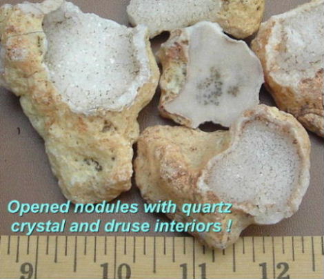
Although this area is a only a long "day trip" for us, we hadn't been there since 2004. On both our 2003 and 2004 trips the Actual road described in the Oregon Gem Trails book had been thoroughly washed out by the big 2003 flash flood(locals back then told us there hadn't been one that big for 10 years). We didn't attempt to get to that "final destination" and hounded around elsewhere farther down the main road with plenty of fun results. Mostly we walked the washed gullies and climbed a few hills finding often dark but colorful jasp-agate, jasper, gray or white mossy agate chunks and white/clear agate nodules that resemble lumpy potato pancakes! Some of the nodules had botryoidal or druse crystalline cavities and so we loved them as specimens and hoped to find more this trip.
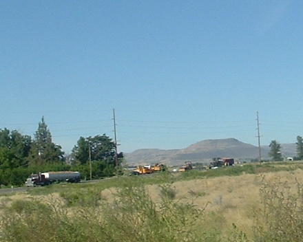
Our drive from home to the Owyhee Ave turn off was long but "normal". 2 1/2 hours mostly listening to Bob Dylan's autobiography audio book on CD and sipping our caffeine beverages trying to get fully awake. There was some of the usual summer "Road Destruction" (i.e. construction) with a flagger on the small highway past Nyssa but we weren't stopped for long. Off in the distance the mesas that call rockhounds are visible for a long while before the turn off.
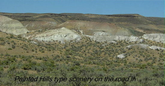
Beckoning! YES! What's out there THIS time? Compared to many more barren Oregon sage-desert drives this one is rather scenic and pleasant. As usual for the general area, the road was lined with a portion of the local onion crops that roll off the trucks at every turn (why don't they use nets?) A few home yards have old wooden wagons in them and there are a few historical landmarks in the area of interest to non-locals. This time of year the corn is high and waving.
For any of you who have been to the Nyssa rock show at the school grounds in July for "Thunderegg Days" be prepared for a horror though! The enormous spreading shade trees that gave the venders (and buyers) a Heaven of summer shade have been butchered to the trunks. It was an awful sight and sad since a good show will be transformed into a furnace now.Our Favorite sight is the rock fronted building at the turn off the highway in Owyhee. Owyhee Ave is sure an Appropriate turn to the hounding area !
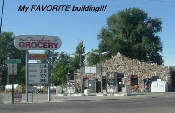
All those pieces sticking up off that building are petrified wood! Sure wish our house looked like that!
When we got out to the dirt/gravel we noticed the road was actually worse than before. This was probably due to the heavy winter causing more runoffs. We had to laugh since it's already the WORST of ALL the Oregon back roads we've ever been on!(except for a few we've given up on!)
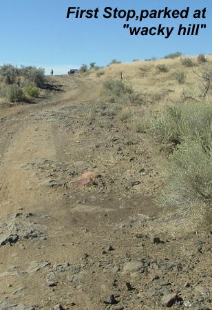
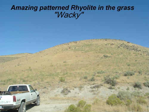
Our first stop was 2/3 of the way in; a very round hill that in 2003 was a bare landslide of the most patterned rhyolite, "almost jasper" rock I'd ever seen. I call it "wacky rhyolite". Now covered with grass we wondered if it was blasted a few years ago for the best material. It doesn't look steep enough for a rockslide of the magnitude we originally gazed at. Nature has gone-to-town covering it back up!
Our pieces didn't polish well, more like wonderstone and pitted too, but they make the greatest possible yard rocks,real eye catchers.
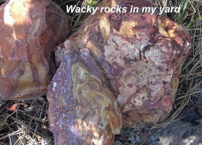
I suspect there was or is some true jasper of this stuff somewhere that polishes. So often the "good" rock in this area graduates from rhyolite to jasper to agate to opalite right in lots of poor grade porous
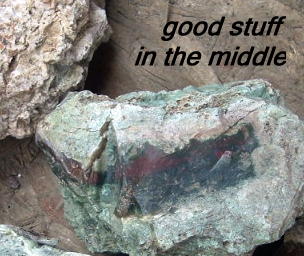 junk. The good stuff has often busted out of veins and pockets in lava-tuff or "rotten" ancient basalt too(and is nestled in plenty of dirt). It's "iffy" just what's what by "appearances" because a light weight porous ugly eroded rock of pale green might have very pretty hard forest green or red jasper or agate as Only a small layer in it's very MIDDLE!
Moving on, we hoped that after two years Someone would have finally re-tracked the actual last leg (last main turn) of the rockhounding road for us to follow to the "mapped" collecting area. To our delight we were right! It was back where the book and Ore-Rock-On maps show a road! Three years ago it abruptly ended 1/3 way to the destination with a 4 foot drop off into a scoured wash! So on our third visit to the area we turned onto It for the First time Ever and drove to the end we'd always wondered about. Well, it was the first "end", but hadn't gone up steeply to the top of a mesa as described yet. We stopped in a parking area to get our bearings anyway. There were PVC claim tubes scattered all around by a BLM looking gate (no logic to them) and some small dirt ruts going another direction. While I was donning my sunscreen (it was warming up fast out there by 10am) a couple from Medford showed up. They'd walked down the gated road I already mentioned. Unfortunately they were looking for "Owyhee Picture Jasper". I explained that "Owyhee Picture Jasper" is a private claim's NAME and doesn't even come from the area we were at, at all, but is closer to Succor Creek! There's a huge Owyhee County and Owyhee desert in Nevada too and people get all of them mixed up! Rockhounds have a lot to figure out when seeking specific materials!
We went away from the gate to check out the dirt tracks and see if that "road" went through.
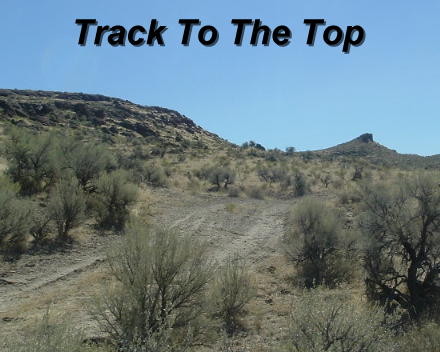
It did, so we came back and drove up the small bumpy track, passing more claim markers and stopping to check things out a couple of times.
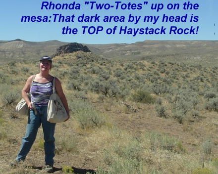
Then up up and away onto a mesa! Thank goodness there were no more claim markers on Any side of us by the time we got "up top" either! It was fun to be almost level with the top of Haystack rock and there was enough odd and varied material to keep us busy until time had flown.
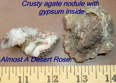
We found a few pieces of jasp-agate and jasper pretty enough to keep but mostly we were attempting to gather and highgrade all the weird crusty agate nodules. These were all corroded looking, not the pure white ones we'd found before.
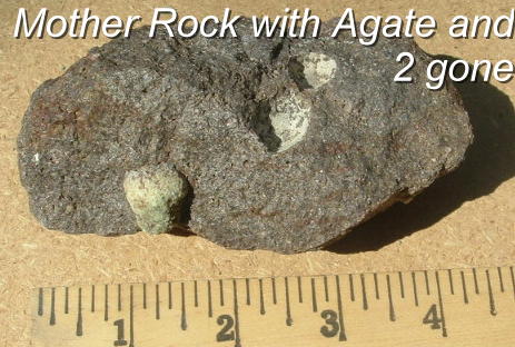
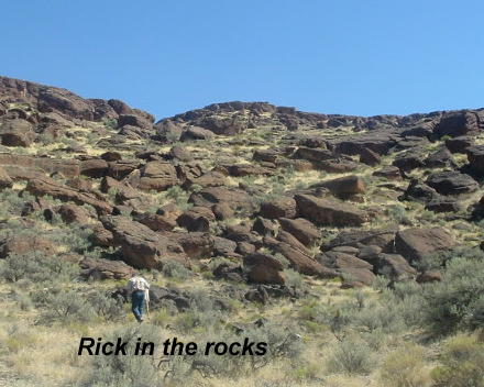
Mostly Rick picked around the flat mesa top where erosion was showing material peeking out. I went around the sides of the mesa(where it was safe to follow the scree down a ways) finding some dug out jasper and crumbly opalite veins and eroded out nodules sliding down the sides. I found a piece of host rock with an agate sticking out for a cute specimen too. I call those "Mother of Agate".