Hello Rockhounds!
This trip was one long time in coming for me!
About 10 years ago I was in fact at Dismal Swamp. MY planned trip got usurped by other people and their ideas though and I never even got to dig or screen! Too complicated a story to tell, but it went down as the worst
 rockhounding trip of my life. Dismal had lived up to its name, and became a standing joke with me!
My husband Rick had heard me moan about Dismal Swamp for 6 years and how Id
missed out. When I said we HAD to go THIS summer, meaning NOW, he was all for helping me break the curse! We had it on good authority that no one would want to drag a trailer on that road (thanks CS) and so Rick built a wood
contraption for the PU that I fondly call Guinans Hat (Thats a Star Trek NG reference). Its a removable storage unit that doubles as a picnic table to go under our shade tent! I want a newer PU with camper shell, working
 odometer, and especially air conditioning but I havent put my foot down about that yet. Haha. Ricks truck keeps getting refitted!
We set out during the dog days of our hottest July on record for about a 6 hour drive. Part of that time included a very slow scenic road and some extra route scouting, but it was well worth it! Boise, 3 hours in for us, was due to be 100+ that day but a blessing of cloud cover helped our lack of air conditioning be bearable. Our route left civilization going north on highway 20 at Mountain Home, Idaho. I soon got to smile, seeing roundly eroded formations, which were like guardians on both sides of the road. I told Rick NOW we are really starting our adventure! Were through the Gateway to the Land of Crystals! You have to pardon me but I talk like that ALL the time. Heck, I believe the
 world is as magical as we Want it to be anyway!
On our route there are two roads to Pine-Featherville and the historical mining
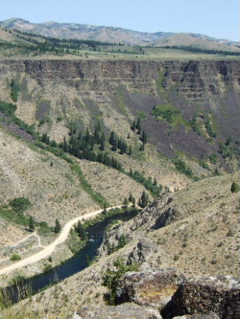
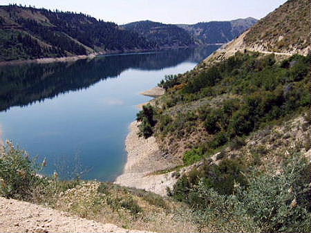
area of Rocky Bar. Dismal Swamp is beyond that. One road is gravel and at first is high above a river canyon, then winds along the scalloped edges of the huge Anderson Reservoir for miles and miles. There are all sorts of shallow inlets the road twists around. That road adds an hour to the trip but was gorgeous in the morning air. The other is inland from the other side of the reservoir and now days an all paved straighter shot to Pine. Naturally we took the gravel road (haha) and WOW that was sure the right choice. It was stunning out there! First is a canyon picture then a couple of the deep clean blue waters! There is another route from Boise that is gravel all the way and I think its that road down by the river in the picture! We may take it some day just to see it but I consider it the back way and heard its a lot of washboard. I like scenery but not being rattled to death!
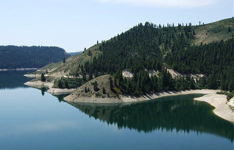
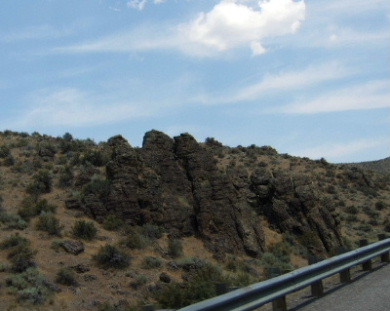
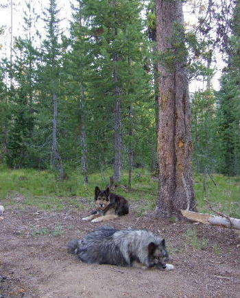
It was a Tuesday morning and only a few boats were out on that pretty water and even from high up on the road I could see big fishies were rising, making rings on the surface. The banks of the reservoir had neat lookin erosion from water levels and the road cuts were full of quartz, some bluish, and feldspar. I got a chunk with an iridescent mineral that almost looks like chalcopyrite to me but I have no ID yet. The rock books dont have any hunting marked but I bet there are some good mineral specimens along those miles of road cuts for those to have time to really search. We had to keep ourselves going. Setting up camp is a major operation for us! We have tent with aerobed, solar shower tent and anti-bug screen tent (now with portable table) as well as dog area All to establish when we get someplace! The times we opt for a motel are sure easy!
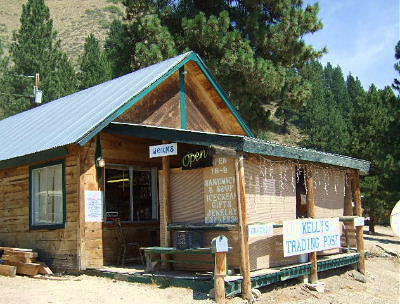
At Featherville there is no Dismal Swamp turn, but the FS road to Trinity Lakes is it, and simple to spot because the main road turns sharply away from it at a fork. We stopped at the little store, Kellys, for cold drinks and discovered it was also a rock shop even though theres no sign about that! The owners have a terrific display and hoard of Dismal Swamp smoky quartz and some other rocks and minerals as well.
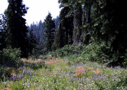
On we went! We discovered that although 3 FS roads are then involved in getting there, NONE have signs going IN when you need them! The funny thing is that all the numbers are marked going back out! If you are wondering if you are on the correct FS road just check in your rear view mirror at the forks! Haha. The mountain road in had gorgeous views and the wildflowers were in full bloom. That high up July is still Spring!
 When we got near the hounding area I didnt recognize anything from 10 years ago. There were a couple of campers long before the swamp area, and getting out and walking around I understood the creek was through the brush behind them. In the old days all digging was in a big wide swamp area or in some hard rock hillside on a side road. I didnt see any of it.
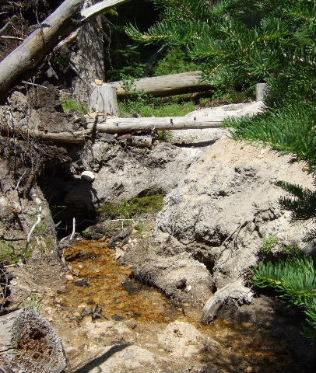
We drove a bit then backtracked and picked a spot across from an inhabited site. As soon as I was out of the truck stretching a movement caught my eye. I saw a human and ran over to ask him what was what! The friendly young man named Robert said that these days most folks dig the creek, not the old swamp, which was another mile or so down a really badly eroded road. My e-mail info from a nice rockhound named Karol had also said creek. Because of my past image of the place I wasnt sure where she meant. Now I got it.
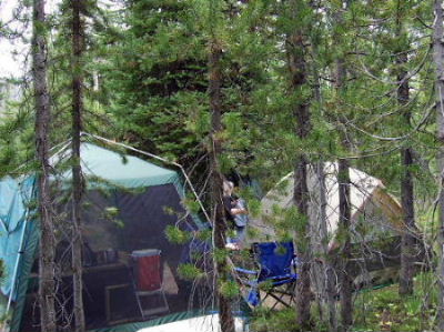
We shielded our camp from the road with the truck and set up backed into the trees and brush. The deer flies were all over us while we worked. Rick had shorts on and had been sweating from the whole day driving in the heat and they fiercely attacked him despite a wonderful organic spray, Bite Blocker, that was working for me and the dogs! I had long jeans protecting my legs though! The trick to avoid the flies is NO SHORTS, no sun and no sweat! After our washing up and sitting in the shade awhile we got mostly left alone.
Our first full day was Wednesday and we opted to plunge down the rolling lumpy road to find the old swamp area and explore. If you plan a visit there are some more campsites down there. I was looking for Anything I might remember from 10
 years earlier. I had been with some hardrock bashers then and we never did find where theyd operated. There was a road covered in deadfall that Rick and I walked up for awhile. I think it might have been going to where Id poked in
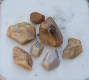
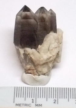
tailings and watched guys bust the bedrock for pockets. We didnt walk far enough for me to be sure though. I did get a couple of tiny sharp clusters from that original journey and I appreciate their specimen value now a lot more than before! Most creek and swamp crystals, no matter how large, have some chipping or rounding to them or hazing of their surfaces.
years earlier. I had been with some hardrock bashers then and we never did find where theyd operated. There was a road covered in deadfall that Rick and I walked up for awhile. I think it might have been going to where Id poked in
tailings and watched guys bust the bedrock for pockets. We didnt walk far enough for me to be sure though. I did get a couple of tiny sharp clusters from that original journey and I appreciate their specimen value now a lot more than before! Most creek and swamp crystals, no matter how large, have some chipping or rounding to them or hazing of their surfaces.
We spent a few hours screening in the old area pits that morning. Rick and I each found one small whole, but chipped, crystal and I collected several very eroded but interesting pieces of lighter quartz with partial crystal faces or imprint zones. The field in their picture is the top of a bucket so you can see they are biggish chunks. As I dug, a lot of ordinary quartz came out that I inspected. Next trip I wont spend so much time on it!